
Abington Township ZIP Service Areas
Abington Township’s official feasibility-plan document identifies five ZIP service areas that traverse the Township municipal boundary. That is the key fact for a ZIP code directory search: all five can touch Abington Township, but none should be read as a municipal boundary or a claim that every address bearing that label lies in the Township. The plan supplies postal area labels, not a post-office-station inventory or a ZIP-level resident count.
| ZIP Code | Township-plan postal label | Post office | Municipality note |
|---|---|---|---|
| 19001 | Abington | Not identified in the Township source | Service area crosses the Township boundary. |
| 19006 | Huntingdon Valley | Not identified in the Township source | Do not equate postal label with Township inclusion. |
| 19038 | Glenside | Not identified in the Township source | Service area crosses the Township boundary. |
| 19046 | Jenkintown | Not identified in the Township source | Service area crosses the Township boundary. |
| 19090 | Willow Grove | Not identified in the Township source | Do not equate postal label with Township limits. |
These are the complete five areas named by the Township plan. A different mailing city on a card or directory entry is a prompt to verify the individual address, not a reason to rewrite the source label.
Abington Township ZIP Code Boundaries
ZIP Codes are Postal Service delivery-route constructs. Census ZCTAs are generalized statistical representations of those delivery areas. Neither is a legal municipal boundary. The distinction matters throughout Abington Township because the plan’s five postal areas cross the Township line. An address may carry a Glenside, Jenkintown, Huntingdon Valley, or Willow Grove label and still require a municipality and parcel check before it is treated as a Township record.
Township examples confirm the practical overlap without defining a ZIP boundary. The municipal office and Roslyn examples use 19001; the Ardsley Community Center example uses 19038; and 515 Meetinghouse Road carries a Jenkintown 19046 postal label. Those examples locate specific Township facilities. They do not establish that every address in the same ZIP is within Abington Township.
The Abington Township Code Chapter 111 documents the Township’s building-number authority.
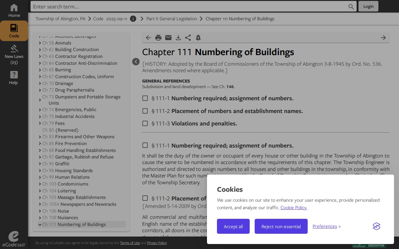
For a questionable number or label, the Township’s addressing authority and the parcel record provide stronger local evidence than the postal city alone.
Abington Township ZIPs 19001 and 19038
The 19001 postal label is Abington in the Township plan, but its service area still crosses the municipal boundary. It appears on the Township office and Roslyn examples, so it is a useful first delivery clue for an address already tied to Abington. It is not an automatic Township determination. Confirm the municipality, then use the address and parcel context if the record question concerns a particular property.
The plan labels 19038 Glenside and gives the Ardsley Community Center as a Township example. That makes 19038 a familiar local postal label, not a stand-in for an Abington municipal boundary. Preserve the postal city printed on a historical source and separately record the municipal conclusion supported by the parcel or recorded land trail.
Abington Township 19046 ZIP Context
The plan identifies 19046 as Jenkintown and says the service area traverses the Township boundary. The Township parks directory’s Meetinghouse Road example uses that postal label. A reader working from a Jenkintown address should therefore avoid assuming the property is outside Abington Township, just as a Township address with another postal label should not be assumed to lie inside it. The check is address-specific.
When ownership history matters, use the address or parcel in County Property Records and then compare the Recorder’s legal description or plan reference. A recorded legal description identifies land in a document; it is not an ordinary mail address, but it can resolve a postal-label mismatch.
Abington Township ZIPs 19006 and 19090
Huntingdon Valley is the postal area label for 19006, and Willow Grove is the label for 19090 in the official plan. Both service areas cross the municipal boundary. Neither label automatically answers whether an individual address belongs in Abington Township. The plan does not support a ZIP-level population, property, registration, sales, or resident total for either area.
That absence matters. This postal index should not promise a downloadable inventory of people or parcels for 19006 or 19090. Use the delivery address first, then the municipal and parcel record for a government-record location question.
Checking an Abington Township ZIP Code
The local workflow starts with one delivery address, not a ZIP-wide people search. The USPS ZIP Code Lookup by Address checks the mailing ZIP for that address. Then use the confirmed number and road in Montgomery County Property Records, selecting municipality ABINGTON. If a property-history question remains, compare the parcel or address with the Recorder’s recorded documents. Finally, use the Township map to confirm ward, voting place, services, or other civic setting.
- Check the exact delivery address through USPS and retain the returned postal label and ZIP code.
- Enter the same number, street, suffix, and municipality ABINGTON in County Property Records.
- Use the parcel or address in the Recorder system when the recorded deed, plan, or legal description matters.
- Use the Abington Resident Information Tool for civic geography, not an owner or resident lookup.
- Compare the documented Township result with the postal label rather than assuming either system is wrong.
The USPS by-address lookup is shown here as the first delivery check.
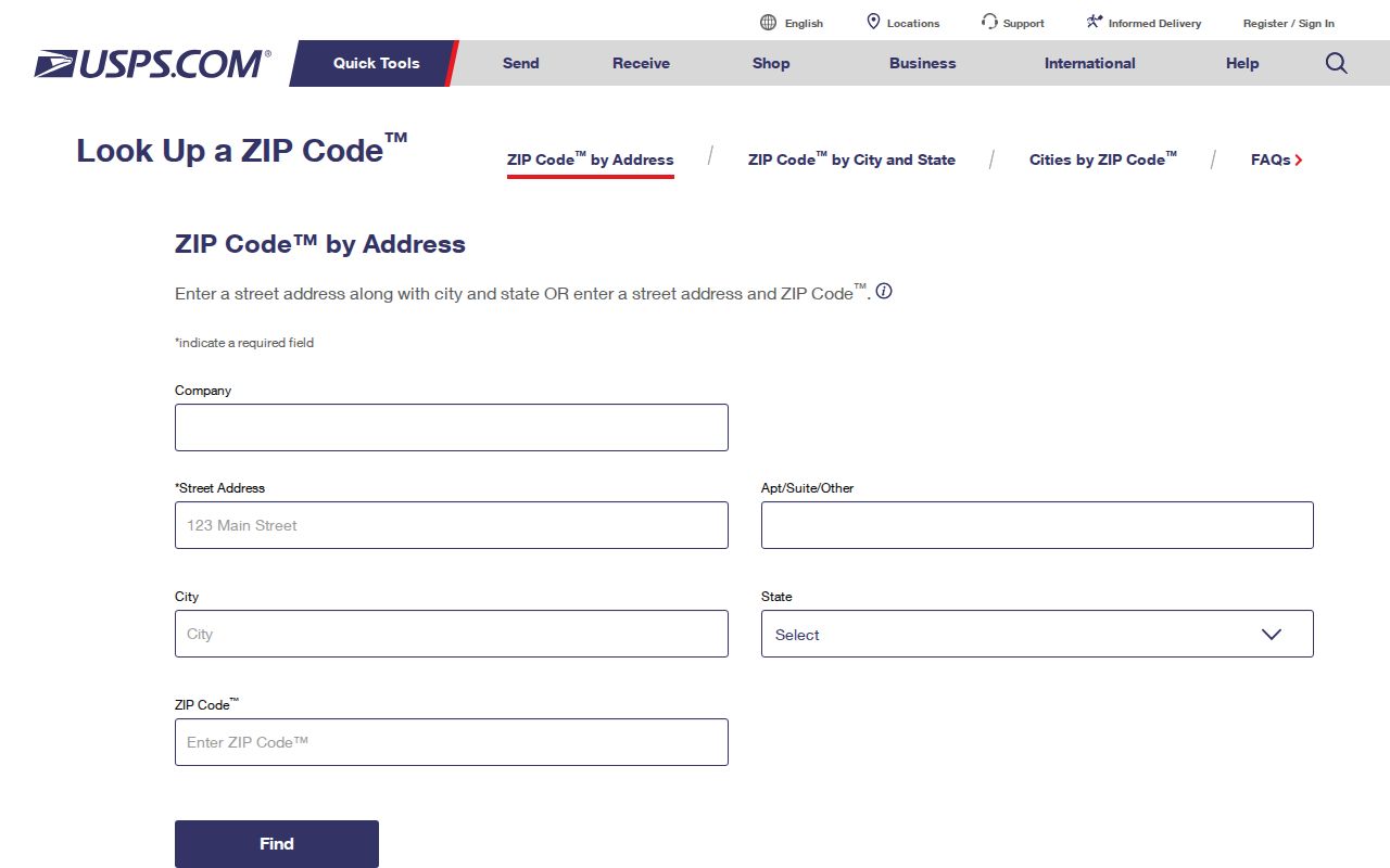
After a ZIP narrows the address, use the Abington Township street directory for the detailed address-and-parcel workflow.
Abington Township ZIP Portal Limits
Montgomery County Property Records is not ZIP-capable. Its public address form takes Number, Direction, Street, Suffix, Unit #, and Municipality, but exposes no ZIP field or ZIP filter. Its Advanced Search, Map Search, and Sales Search appear in navigation, yet the complete advanced field list was not captured. The Township map’s underlying data has a Site_Zip_C field, but the public popup does not display it and the public search is address / Site_Full_, not ZIP.
| Local search control | Role after ZIP confirmation | ZIP capability | Documented limit |
|---|---|---|---|
| Number | Optional address field | None | Maximum six characters. |
| Direction | Optional address field | None | Blank, E, N, NE, NW, S, SE, SW, or W. |
| Street | Required address field | None | Maximum 20 characters; wildcard and partial-street behavior documented. |
| Suffix and Unit # | Optional address fields | None | Use the form’s suffix menu and unit field when known. |
| Municipality | Location control | None | Select ABINGTON for Township property results. |
No official public local portal was found that creates a ZIP-wide property, person, or full-address inventory. A ZIP can help confirm a specific address, but it cannot be used as a local resident-browse filter.
ZIP Postal Layers in Abington Township
Three address layers should remain distinct. A situs address is where a property is physically located. A mailing address is where correspondence goes. A legal description is the recorded land description found in a deed or plan. A mailing ZIP can cross a municipal boundary, while a legal description is a property-document reference and a Township parcel record supplies the local location context.
For a historic address, keep the postal label printed in the dated directory, map, or notice. Then compare the street number, suffix, municipality, legal description, map period, and post-office label. Historic terminology should be treated as a research lead, not silently converted to a modern postal city.
Note: A postal mismatch can be accurate in both systems because delivery labeling and municipal record geography answer different questions.
Abington Township ZIP Definitions
Use these postal terms carefully. A ZIP directs mail to a delivery area, while ZIP+4 adds a more specific delivery segment. A PO-box ZIP is used for post-office boxes, and a unique ZIP is assigned to a single high-volume recipient. The Township research did not identify a PO-box-only or unique ZIP among its five service areas, so neither should be assumed here.
- ZIP
- A Postal Service delivery-route code, not a municipal boundary.
- ZIP+4
- An added four-digit delivery segment associated with a ZIP.
- PO-box ZIP
- A ZIP used for post-office box delivery; none was verified for the five Township service areas.
- Unique ZIP
- A ZIP assigned to one high-volume recipient; none was verified for the five Township service areas.
- Carrier route
- A mail-delivery grouping that does not define Abington Township’s legal limits.